Friday, December 09, 2005

A (very mild) cure for the common inbox

A cure for the common inbox: Posted by Jared Jacobs, Gmail Engineer

Right place- wrong thing. It be much niftier to integrate Google Reader. I see this as something that is more for people who still don't really get the whole subscription concept. I am not one of these people who wants rss feeds in my inbox (unless they are the search alerts associated with ME personally), but I would like to see a little integration.

Google could now have four separate lists of RSS feeds for me associated with the personalized homepage, the afforemention Reader, Google Desktop 2, and now in Gmail. Only one of these imports OPML...if I worked at Google my 20% time would be spent 100% on at least loosely integrating all of the stuff they already have.

Thursday, December 08, 2005

The Wrong Tale: The GIS Long Tail


So, I was reading the new Squidoo lens on the Long Tail, and I realized it's becoming one of those things that can mean whatever you want. Something bothered me when I saw this thing a couple of months ago from Dave Bouwman.

The first thing is that the long tail isn't that long, relative to the short tail. Or, rather, the area under the tail is pretty small. I wonder what would happen if we had actual numbers on the y-axis: does anyone know how many users there are of Mapquest, Yahoo Maps, Google Maps, Windows Local Live/Virtual Earth, Google Earth etc. compared to the users of specialized GIS tools? It's probably a pretty high ratio. This makes the long tail a lot shorter, and the slope a lot steeper.

One reason that the Long Tail makes a lot sense for things like books is that there are millions of books to choose from. But it's not the guy that sells one book out at the far end of the tail that gets rich, it's Amazon with a virtual warehouse that sells the whole long tail. If users paid for their GIS software per use, the model might make some kind of economic sense. The people that use GIS alot, want some complex GIS features. The people that are looking at pretty pictures and want to find the shortest route to Grandma's house (it's over the river and through the 'hoods) don't need it, in fact, they don't need to pay at all.

The real question is at what level people will start paying for features. There is a point somewhere between Google Earth Pro and ArcInfo where people really do have a choice in terms of what to buy. The biggest change that has developed in the past two years is that the feature list of the free stuff keeps creeping upwards, and taking some of the left side of the tail away from the people that sell things. When you have services with APIs and lots of free data, that changes the game. It grows the whole market, so there is a lot more demand for data, data that has to be created with the advanced tools.

Anyway, I'll draw up a new tail tomorrow and we'll see how it looks.

Earned Value Management

EVM is a messed up concept. I estimate the design will take 20 weeks. It takes 10 weeks. I earned 20 weeks of value, yea!!! Except there's no value to the customer. Don't give intrinsic value to time- give value to the actual value delivered to the customer.

Of course, working for the government, they can demand that you give value to the non-real tasks. I tried to read the document from the CIO Council, searching for any guidance that the tasks to which value is assigned are tasks that have direct value to the customer, not tasks like "create test plan".

In IT projects, value only comes from value delivered to customers. Putting meetings on the schedule and "earning value" by getting to the end just doesn't make sense.

Letting Go and theTest Drive

This is a funny little post about "the fall from scaffolding". I had never really imagined that people would try to completely depend on the scaffolding and not actually stick any of the back end code in there, but I guess it's more than possible, it's happening.

I think the comment by the Python guy on Django is a little sad..."Rails just gives you scaffolding, Django gives you the whole house!
" He's taking the angle that the author is just now discovering that there's more to Rails (and Ruby) and using that to imply that there is nothing else there, and some how more in Django. Sick rhetoric- why does everything have to be such a competition. I think people should have known for a long time that it's not comparing feature lists that makes people choose one technology over another. If it was, you'd pick out your car strictly from the spec sheet without looking at it or taking a test drive.

The test drive that comes with Rails is really really good. The acceleration (in terms of how long it takes to get running) and miles per gallon (in terms of features delivered per hour) are great too, but it's really about the feeling you get that makes it different.

local.live.com


Remember Virtual Earth? Forget Virtual Earth....

In a move that seems really really too similar to the Google Maps to Google Local transition, we now have Windows Live Local.

I think it is much clearer that this is a competitor with Google Local than Google Earth, even with the 45 degree angle shots that I clipped here. I also think it's interesting that they are calling this Windows Live versus Microsoft Live. I think Windows is a far better brand than Microsoft. The Microsoft name just has far too much baggage associated with it in too many contexts, whereas Windows and Office are really seen in a much more positive light. I'd be interested to see some numbers behind that.

Google Earth Book

Is anyone out there working on a Google Earth book? O'Reilly?

Refactoring Ruby

Refactoring and Code Completion- two things about Eclipse that are very hard to give up when typing in Ruby. Jon Tirsen's post sums up the challenges in Ruby pretty well, although there are some innovative approaches for doing things like a rename, if you have a fully automated test suite that will throw deprecation warnings.

It's not like Java or (C#) is completely immune to these kinds of things. Once you start writing framework style code (like an O/R mapper or something with great gobs of XML splattered about) and using reflection and the Class class all of the time, a lot of the type safety disappears. In most cases, a class cast exception is no better than what would happen in Ruby. The concept of method_missing is also a neat way to deal with what happens when duck typing fails.

In any case, the ascent of dynamically type languages continues. Python, which appeared to be the heir to Perl, is rolling with some well made new web frameworks. Ruby is selling more books though, according to Tim O'Reilly. The debate Ruby vs. Python really doesn't matter toooo much, although I suspect that the Ruby will end up in more enterprise locations, once people like Justin and Stu get the Enterprise kinks worked out.

Anyway, I know code completion and refactoring make me a lot more productive. It is an open question whether the other gains of Ruby/Rails make up for that loss.

Monday, December 05, 2005

Google Earth enterprise consultant

I am seeking resumes from geniuses who want to do consulting on enterprise installations of Google Earth in the Washington, DC and Baltimore, MD metro areas. US citizenship required. Resumes and cover letters to jobs@lmnsolutions.com

Sunday, December 04, 2005

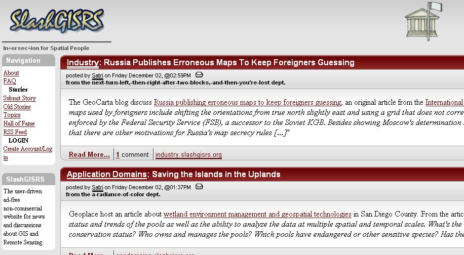
Slashdot for GIS?


Well, there aren't many discussions yet, but SlashGISRS is using the same website engine. Where is the best discussion forum for GIS in the general perspective? I tend to spend time on the ESRI Developer Network (despite it's limited Java and Avenue coverage) or the Google Earth "BBS", but neither of those is really a general purpose site.

What makes Slashdot Slashdot is the community. There's enough people posting stories and commenting on them that it actually ends up getting interesting information fast. So, while using the same software is great, SlashGISRS (why the rs?) needs commenters and submitters to be worth going to. Aggregation without editors is the other approach, and there may be some smarts that can be put in there to keep the most interesting and recent stories up there, but that's not as easy as it sounds.

Friday, December 02, 2005

ArcGIS Explorer...Still not done

James says:

To be able to take ArcGIS Server, ArcIMS, WMS, ArcWeb Services and other types of GIS datasets and display them all in one program really speaks volumes of what ESRI is trying to accomplish here. ArcGIS Explorer seems to be the product that Google Earth should have been.


It seems really snide to say "should have been". Google Earth isn't just a client- they're serving up an unprecedent quantity of imagery, elevation, and vector data at amazing speeds to a huge number of users. That really changed the game for all of the people that don't have ArcGIS Server, ArcIMS, WMS, etc services that cover whole world available to them. GIS isn't much fun without good data, and Google Earth has exposed a lot of people to data that they didn't even know existed.

By James's definition of "should have been", Google Earth should have been the viewer for ESRI data formats...maybe if Keyhole had been looking to get bought by someone else. In reality, the server side of Google Earth changed the game in terms of scaling 3D imagery services and the client changed the way most people who used it thought about GIS user interfaces (apparently to include ESRI). Hacking across data formats is a nice side business for system integrators, not really the primary focus for most innovative product companies [reference ESRI support for OGC standards].

Here's one big thing missing from ArcGIS Explorer so far- the ability to create data. A community sprung up around Keyhole and then Google Earth in large part due to the ease of creating data and sharing with it others. Now, you probably wouldn't use this kind of tool to produce datasets that you would sell, but it handles the long tail of applications for the occaisonal GIS user.